Prairie Mountain
Elevation: 2210 m
Elevation Gain: 700 m
Located in the Elbow River Valley, just west of Calgary, Prairie Mountain is a rounded peak that was named for its broad, grass-covered summit (which provides a wonderful view of the actual prairies further east). Before it was officially named in 1939, those in the Stoney Nation referred to it as Îyarhe Wida Tagichuwaga, which translates to “Younger Brother of Island (Moose) Mountain.” Prairie Mountain’s first recorded ascent is attributed to surveyor C.S.W. Barwell, who set up a triangulation station on its summit in October 1896. Today, the peak is often ascended by hundreds of hikers every day, thanks to a well-established, recently repaired and upgraded trail.
My Ascents:
June 30 2024, May 3 2013, June 6 2012, March 7 2010, May 19 2008
Trailhead: Elbow Falls Parking Lot
GPS Track: Prairie Mountain (Upgraded Trail Opened September 2023)
With the 🍁 Canada Day long weekend upon us, Brianne and I decided that another family hike was in order. Many years ago, in a pre-kid life, I would have taken one look at the weather forecast and said: “let’s go Saturday or and Monday” (since Sunday promised nothing but rain) 🌧️. These days, I take what I can get when it comes to hiking, and Sunday was the only time that our family calendar wasn’t bursting at the seams. Come hell or high water (with the latter very probable) 😬, we therefore decided to test our rain gear on a soggy Sunday.
With a 90% chance of 10 – 20 mm of misery 😑🌧 forecast, we limited our potential for suffering by choosing to attempt Prairie Mountain. We felt that Prairie was the right choice because:
a) It’s close – no one wants to spend 2 or more hours in a car full of stinky, wet children. 👃
b) It’s short – how wet can you really get on a hike that’s only 9-km return?
c) In the event of a whiteout, we’d seen the view from the top before anyways (though not often…).
d) We’d yet to check out Prairie’s recently upgraded trail and were curious.
e) Brianne and I hadn't been up Prairie Mountain together in years - in fact, Prairie was our first "mountain date" together!
Driving west through a deluge, we were glad we’d picked Prairie and not something larger. In fact, the decision to do anything outside was beginning to seem questionable! Nevertheless, we elected to proceed since we’re not made of sugar (Brianne is sweet, but not that sweet). Donning our rain gear at the, less-busy-than-usual, Elbow Falls parking lot, we set off!
.jpg)
.jpg)
LEFT: After carefully crossing Highway 66, we easily located the beginning of the new Prairie Mountain trail. This trail dramatically reduces the grade/steepness of the hike, which is saying something seeing as it still looks pretty steep right from the get-go! 😂
RIGHT: The steepness presented no issues for 1-year-old Lillian (who found a mountain goat to carry her up). 🐐
.jpg)
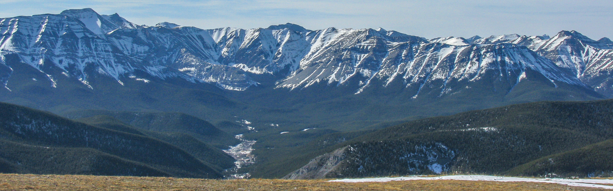
After a steep first switchback, the trail leveled somewhat and provided pleasant, if not soggy, views towards Îyarhe Îpan on the opposite side of the Elbow River.
.jpg)
Turning away from the river, the trail followed Prairie Mountain’s gentle southeast ridge up towards the steeper forested slopes ahead. Even on a rainy day, the trail was still very busy and a number of groups passed our relatively slow-moving family.
.jpg)
Upon reaching the steep forested slope, the contrast between the old trail (covered with brush, deadfall and logs on the left) and the new trail on the right was quite apparent. The old trail went straight up a slope that was TFS (too f***ing steep). The new trail, on the other hand, switchbacks more easily up a slope that is only PFS (pretty f***ing steep). 🙃
.jpg)
.jpg)
LEFT: A completely unnecessary stone staircase partway up proved to be a hit with the kids and shortened the switchbacks that it bridged by at least 50 m!
RIGHT: Penny shows off a very muddy hand (which matches her very muddy pants and running shoes). This is the reason that hiking boots are preferred to running shoes on Prairie Mountain (and most others). Where are Penny’s hiking boots, you ask? In the car at the trailhead because she REFUSED to wear them! 🙄 Despite the fact that they were purchased only 2 weeks earlier and used (without issue) on another hike, they are apparently too small now…
.jpg)
.jpg)
LEFT: Lillian enjoys a respite from her Mom’s backpack atop a stone bench about 2/3 of the way up. These “benches” and a couple of viewpoints were nice additions to the new trail and we all enjoyed them.
RIGHT: Lilly and her ride. ❤️
.jpg)
The three sisters (no, not that Three Sisters 😂) on a rainy afternoon. For evidence of the efficacy of hiking boots relative to running shoes, compare Penny’s pants (left) to Mera’s (right)… 🤔
.jpg)
After holding Penny’s hand most of the way up Prairie Mountain’s still-steep trail slip-and-slide, we finally reached its more open sub-summit slopes, where Mera was thrilled to find herself inside a cloud. ☁️ The more seasoned hikers amongst us were less enamored, but a whiteout day in the mountains is still better than being in the city (in my opinion anyways – don’t ask Brianne for her take on this subject)!
.jpg)
Penny, Lillian and Brianne follow the highway-like trail up, up, up. A brief opening in the clouds here was cause for my favorite kind of hope: false hope. 🙃
.jpg)
The summit comes into view! Sort of…?
.jpg)
.jpg)
LEFT: Lillian loves being carried up mountains but seems to be quite insistent on completing the summit push on her own… This was our second peak in a row where she calmly allowed her Mom to carry her 99% of the way up, before LOSING HER MIND on the homestretch!
RIGHT: Maybe Lilly wanted to walk up to the summit on her own, or maybe she was just hungry for Ritz crackers? Some mysteries will never be solved… 🤷
.jpg)
GASP! A VIEW!!! 👀
.jpg)
A closer look at said view to the west: rocky Nihahi Ridge rises up beyond more proximate Powderface Ridge as a quintet of peaks (from left to right: Mount Remus, Mount Romulus, Mount Fullerton, Black Ridge and Fisher Peak) tower still higher beyond. This view proved to be of the “blink and you’ll miss it” type, and any hint of nearby mountains was soon swallowed up by nearly omnipresent cloud.
.jpg)
A fine family photo in the middle of a cloud. 🥰
.jpg)
After a brief summit respite, we exhausted our supply of Ritz crackers and elected to start back down into the great gray beyond.
.jpg)
As we made our way down the sub-summit slopes/ridge, the clouds (of course!) began to lift. My (half-joking) suggestion to go back up for the view here was quickly rebuffed, so we continued down with visions of dry clothes dancing in our heads.
.jpg)
.jpg)
LEFT: A much-improved vista over nearby Vent’s Ridge towards Banded Peak from one of the new trail’s viewpoints.
RIGHT: Brianne explains the merits of hiking boots on a rainy muddy day to a 6-year-old who could care less. 😂
.jpg)
.jpg)
LEFT: 8-year-old Mera tears down the trail 🏃♀️ towards Îyarhe Îpan (thanks to her grippy hiking boots and new-found passion for peak-bagging).
RIGHT: My girls enjoy the hike’s last lookout. From here, a quick switchback delivered us to the trailhead by the river below, where we eagerly traded muddy boots for sandals and turned up the heat for our drive home.
.jpg)
Hmmm… This isn’t quite home, but a quick side trip to Big Beaver Brewing in Okotoks is never a bad idea because it has fine ales for adults and…
.jpg)
… A fine play area for their kids! Cheers to getting out to the mountains with family (rain 🌧️ or shine)! 🍻