Opal Ridge South Summit
Elevation: 2575 m
Elevation Gain: 1020 m
Opal Ridge is the unofficial name for the ridge featuring tightly folded rock strata which lies immediately to the west of the larger Opal Range. The “Opal” name was bestowed by a Dr. George Dawson’s geological survey team which discovered quartz crystals coated with opals in the area.
My Ascents:
July 1 2014
Trailhead: Fortress Junction Service Station
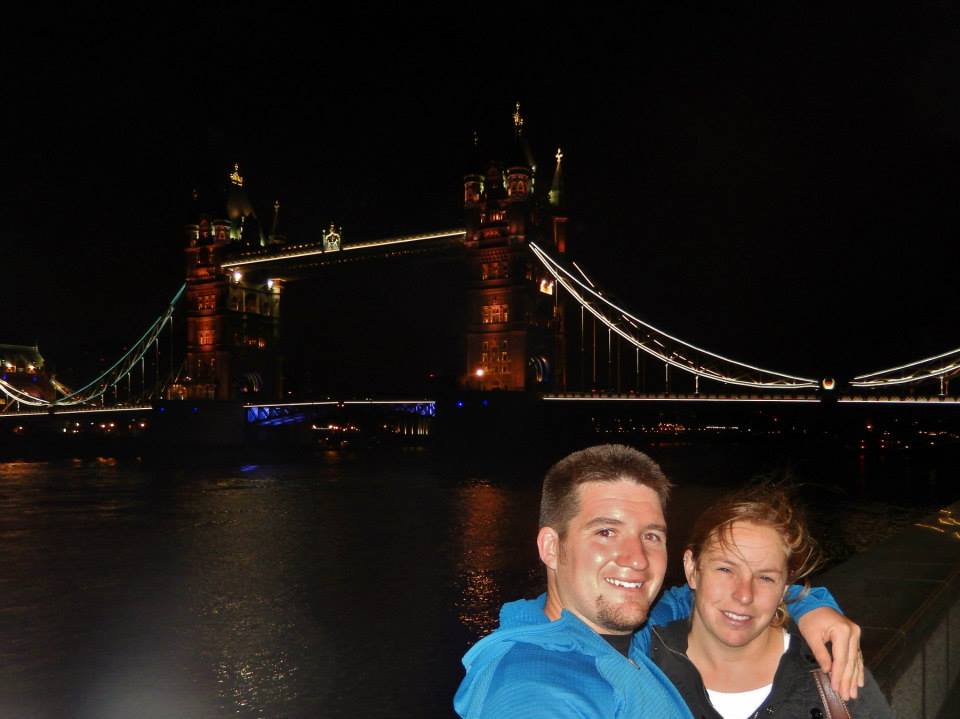
After a whirlwind 6 day tour of England, I decided that elevation gain would be an effective cure for jet lag. Thanks to Canada Day, a group of friends and I actually had a day off together with no interference from life’s usual commitments. Seeking a scenic objective suitable for everyone, we opted to make our way up Opal Ridge’s south summit. The steep ascent slopes ensured the “need” for plenty of breaks which granted us a perfect chance to catch up with one another!
.jpg)
After meeting at the northeast corner of the Fortress gas station parking lot, we easily found a trail leading east up the hill towards a set of power lines which we followed north. After a couple of minutes under the power lines, we crossed the stream pictured here and found the Opal Ridge south summit trail by a large cairn.
.jpg)
The sun rises behind our objective. Easy scrambling on good but steep trails led us up the slopes on the left hand side to the broad ridge crest 1000 m above. Once on the ridge, a pleasant walk brought us to the cairn and register marking the south summit of Opal Ridge.
.jpg)
The route passes through a variety of small rock bands which offer the opportunity for some hands-on scrambling.
.jpg)
Large horn coral fossils adorn many of the rock bands on the peak’s lower slopes.
.jpg)
As we gained elevation, the rocky slopes became grassier and we were treated to a colorful wildflower display.
.jpg)
Anne and James enjoying the grassy slopes and views of the Kananaskis Valley.
.jpg)
The north summit of Opal Ridge (center right) comes into view beyond several kilometers of connecting up-tilted rock strata.
.jpg)
Crux spies out the route along the ridge to the south summit (right).
.jpg)
Higher up, large cliffs grant Opal Ridge a castle-like appearance. Fortunately, grassy slopes and gullies to the right allow steep but easy access to the top.
.jpg)
Scenic slogging up the steep grass/gully.
.jpg)
Atop the ridge, Crux quickly found his way to one of the few snow patches remaining while we busied ourselves taking photos of the suddenly revealed Opal Range.
.jpg)
Lise and Aurore enjoy the sun and scenery.
.jpg)
James and Aurore finish off the ascent with the pleasant hike to the summit.
.jpg)
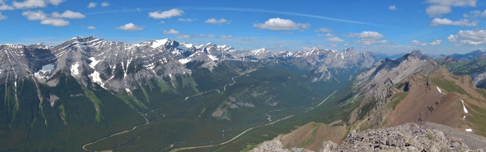
From the summit, the alpine panorama of the Opal Range (left) and the lush green Kananaskis Valley (right) provides ample reward for the energy expended grunting up Opal’s steep slopes. Click to see larger.
.jpg)
The distant glaciers of the continental divide feed Lower Kananaskis Lake which, in turn, drains into the winding Kananaskis River.
.jpg)
Glaciated Mount Joffre highlights the views towards the continental divide and the Kananaskis Lakes (lower on the left, upper on the right).
.jpg)
Mount King George towers above the other peaks to the west.
.jpg)
The perfect way to repatriate oneself following a trip to the UK!
.jpg)
The lush greens of the Kananaskis Valley provide a colorful contrast to the red rocks of Opal Ridge. Click to see larger.
.jpg)
Mount Lawson (left), Kent Ridge North Summit (distant center) and Mount Inflexible (right) offer a wall-like appearance across the valley. The ascent route up Mount Lawson follows one of the visible snow gullies and is every bit as steep and unpleasant as it looks!
.jpg)
Mount James Walker looks like an appealing target.
.jpg)
Mount Galatea, the highest peak in the Kananaskis Range, rears up behind the Fortress. Gusty Peak is visible to the left while the Tower is visible to the right.
.jpg)
Looking north along the colorful length of Opal Ridge.
.jpg)
The northern extent of the Lewis Thrust. From left to right: Mount Bogart, Mount Kidd (South Summit), Aiguille du Cuillière (foreground), Wind Mountain (background), Mount Kidd and Mount Allan.
.jpg)
The Wedge’s sheer south face beyond the north summit of Opal Ridge.
.jpg)
Lise: happy to be out and about in the Rockies.
.jpg)
“Oh hi there. You brought enough steak and potato chips for everyone, right?”
.jpg)
The beautifully vertical rock faces of the Opal Range immediately east across a sublime alpine meadow below. From left to right: unnamed, double peaked Mount Denny, Mount Potts, Mount Evan Thomas, Mount Packenham and Mount Brock. Click to see larger.
.jpg)
A closer look at Mount Evan Thomas: the highest point of the Opal Range.
.jpg)
Group summit shot (minus one mountain dog).
.jpg)
There he is – and getting good summit scratches to boot!
.jpg)
After a long photo-filled stay on the summit, it was time to GTFD. By this time, it was getting quite hot and we were eager to get down to the cold beer, ice cream and shade which awaited us at the Fortress gas station below!
.jpg)
Despite the hurry to get down, photo stops were still compulsory as a result of how pretty this peak is!
.jpg)
Aurore celebrates another non-photography-related stop following the “release of the Kraken” (her words, not mine).
.jpg)
By this time poor Crux was starting to melt in the hot afternoon sun.
.jpg)
Last views of the Kananaskis Lakes (left), Mount Sarrail (center right) and Mount Joffre (right) beyond the alpine wildflowers littering Opal Ridge’s slopes.
.jpg)
A perfect spot for Crux to cool off at the bottom – the rest of us had to wait another 5 minutes before cooling off with our beer and ice cream at the trailhead. Good hike with great company – happy Canada day!
.jpg)
.jpg)
.jpg)