Wasootch Peak
Elevation: 2355 m
Elevation Gain: 900 m
Wasootch Peak is the unofficial name for the peak at GR334455. “Wasootch” is from the Stoney word “wazi” which means “unique” and was first used to describe the shape of the Wasootch Tower which is found near the peak. This peak is also sometimes referred to as “G-8 Summit” after the controversial G-8 Summit which took place at the nearby Kananaskis Village in 2002. The peak overlooks the Kananaskis Village and rumor even has it that marksmen were helicoptered to the summit as part of the security effort.
My Ascents:
August 5 2013.
Trailhead: Wasootch Peak Parking (Roadside)
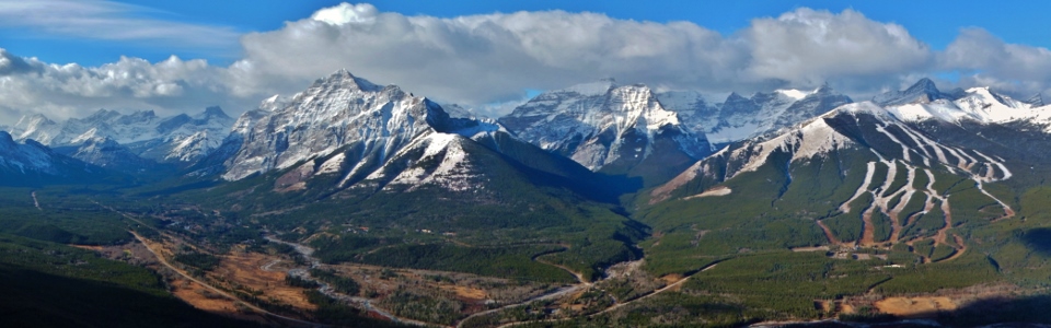
After making my way to the spectacular Icefields summits of Sunwapta Peak and Tangle Ridge over the previous 2 days, I had my heart set on a similarly grandiose summit for the Monday of August long weekend. Unfortunately, ‘twas not to be. Although we had perfect weather on Saturday and Sunday (despite what the forecast suggested), my luck ran out on Monday which I had set aside to scramble with Grant. As Grant and I drove west from Calgary, we stared at the menacing black clouds which obscured our view of the peaks and, in a quick succession of decisions, downgraded our original objective from Narao Peak to Mount Norquay. As the weather grew worse, we downgraded the Mount Norquay objective to the Wedge. As the rainfall increased, we finally settled on Wasootch Peak as our goal since we didn’t feel like being out in the heavy rain for much longer than the 3.5 hour round trip time listed for Wasootch in Nugara’s guide. I’d always wanted to do Wasootch in shoulder season and fortunately, we didn’t see a damned thing from the summit so I’ll probably still get my wish!
.jpg)
The route up Wasootch Peak starts along a trail which parallels the north side of the creek across the highway from the Nakiska/Kananaskis Village exit. We parked on the north side of the creek on the shoulder of the road. The creek was heavily damaged during June’s floods, however, most of the trail is still in good condition. In places (like this), however, the route now follows the gravel laid down by the floods.
.jpg)
The trail comes and goes thanks to being washed over by river rock, however, it is already well-flagged (thanks to whoever donated their flagging tape to this cause) and easy to find whenever it reestablishes itself.
.jpg)
The trail begins to climb out of the creek bed quickly and you’re treated to great views of the flood damage from above.
.jpg)
The view towards Kananaskis Peak begins to open up despite overcast skies. Maybe the weather won’t be so bad after all? Famous last words…
.jpg)
Typical easy terrain on the ridge; the summit now comes into view ahead.
.jpg)
Increasing cloudiness: the silhouette of the Wedge can just be discerned through the mist.
.jpg)
I’m not used to scrambling in places where I get cell phone reception. Good thing I did today – turns out I won a free cruise (or so the robo-caller on the other line informed me)!
.jpg)
Clouds rising up from the valley floor and about to obscure Kananaskis Peak and Mount MacDougall beyond.
.jpg)
Grant negotiates the easy crux just below the summit. Some trip reports indicate the need to scramble up 2 m of rock, however, you can easily avoid this by going through a well-cairned notch just below the summit.
.jpg)
Grant takes the final few steps to the summit soaked from a rainy ascent.
.jpg)
Tiara Peak appears through the cloud and beyond the summit cairn. The register was surprisingly recent and was just placed by the ACC a couple of weeks earlier.
.jpg)
The shapes of Mounts Bogart and Kidd are faintly discernible across the cloudy Kananaskis Valley.
.jpg)
Finally a chance to test my new rain jacket!
.jpg)
Given the nasty weather, we did not stay on the summit long. Of course, as we began to make our way down, the clouds started to clear revealing the familiar forms of the Wedge, the Fortress, Mount Kidd and Mount Bogart.
.jpg)
The clearing granted us a clear view of the flood damage to the Kananaskis River below.
.jpg)
Clouds hang amongst the spires of Kananaskis Peak as the sun begins to shine on descent.
.jpg)
Looking down the ascent/descent route ridge (now that we can actually see it).
.jpg)
Back at the car 3 hours and 15 minutes after leaving and looking back up to Wasootch Peak whose summit was still in the clouds. You can actually make out some orange flagging in the trees in the lower right of this photo – this is where the largely intact Wasootch Peak trail starts. The one good thing about completing such a quick ascent is that we were able to beat the long weekend traffic back and were home in Calgary in time to enjoy lunch-time pints at Brewster’s (OK, not pints – schooners).